Navigating Urban Safety: How 'The Safest Way' App is Redefining Personal Security
A groundbreaking mobile application, 'The Safest Way,' is transforming urban navigation by offering routes based on real-time safety factors like street lighting, CCTV coverage, and crime statistics. Initially launched in select UK cities, this innovative tool aims to empower pedestrians with confidence, addressing long-standing concerns about personal security in public spaces. Its potential for wider adoption and impact on urban planning and individual peace of mind is significant.
In an increasingly interconnected world, where technology often promises convenience, a new mobile application is stepping up to deliver something far more fundamental: peace of mind. 'The Safest Way' app, a pioneering initiative, is fundamentally altering how individuals navigate urban environments by meticulously mapping out routes based on comprehensive safety data. No longer content with simply the shortest or fastest path, this app prioritizes personal security, considering factors such as the presence of street lights, CCTV surveillance, and localized crime statistics to guide users along what it deems the 'safest' available route. This innovative approach is a direct response to a universal human need: the desire to feel secure when moving through public spaces, especially during vulnerable hours.
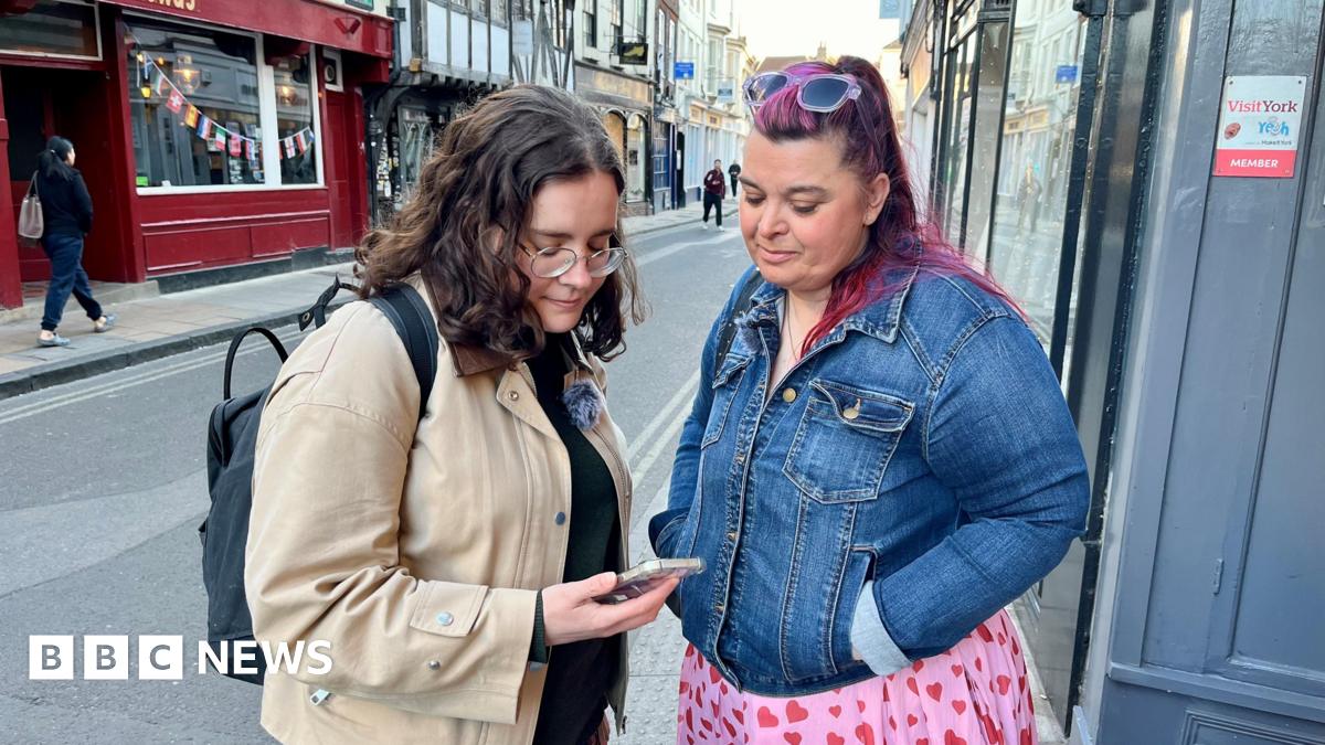
The app's creator articulates its purpose with striking clarity: it's designed for "everyone who wants to feel more confident when they walk around." This simple yet profound statement encapsulates the widespread anxiety many experience, particularly women and vulnerable groups, when traversing unfamiliar or poorly lit areas. The initial rollout in key UK locations like York, London, and Northern Ireland serves as a vital proving ground, with developers harboring ambitious plans for broader expansion. The implications of such a tool extend far beyond mere navigation; they touch upon urban planning, community empowerment, and the very definition of a 'smart city.'
The Anatomy of Safety: How the App Works
At its core, 'The Safest Way' app leverages a sophisticated algorithm that synthesizes diverse data streams to generate its recommended routes. Unlike traditional mapping services that primarily focus on distance or traffic, this app integrates geographical information with real-time and historical safety metrics. Imagine a scenario where two routes lead to the same destination: one is dimly lit with a history of minor incidents, while the other is brightly illuminated, monitored by surveillance cameras, and has a negligible crime rate. The app will intuitively guide the user towards the latter. This is achieved through a multi-layered data ingestion process that likely includes:
* Publicly available crime data: Sourced from local police forces and government agencies, providing insights into areas with higher or lower incident rates. * Infrastructure mapping: Detailed information on the location and operational status of street lighting, ensuring users are directed along well-lit paths. * CCTV network integration: Mapping the presence and coverage of public and potentially private surveillance cameras, adding an extra layer of perceived security. * User-generated feedback (potential future feature): While not explicitly stated, such apps often evolve to incorporate community input, allowing users to report issues or confirm safety perceptions, creating a dynamic and self-improving safety network.
The technological backbone of 'The Safest Way' represents a significant leap from rudimentary safety apps that might rely solely on emergency contacts or panic buttons. Instead, it proactively mitigates risk by providing informed choices before a user even steps out, shifting the paradigm from reactive response to proactive prevention.
A Historical Perspective on Urban Security
Concerns about personal safety in urban environments are hardly new. Throughout history, cities have grappled with the challenge of balancing accessibility with security. From ancient city walls designed to protect against external threats to the gas lamps of Victorian London that sought to deter street crime, the quest for a safe urban experience is deeply ingrained in human civilization. The advent of modern policing, public transportation, and urban planning initiatives in the 20th century further aimed to create safer public spaces. However, persistent issues such as street harassment, petty crime, and the general feeling of vulnerability, particularly after dark, have remained. For decades, advice on personal safety often revolved around 'common sense' measures: avoiding certain areas, walking with others, or carrying personal alarms. While valuable, these often placed the onus of safety solely on the individual. 'The Safest Way' app represents a technological evolution of this advice, offering a data-driven, personalized safety guide that complements traditional wisdom with contemporary capabilities.
The Broader Impact: Beyond Individual Users
The ripple effects of an app like 'The Safest Way' could be profound, extending beyond the immediate benefit to individual users. For urban planners and municipal authorities, the aggregated, anonymized data from app usage could provide invaluable insights into perceived and actual safety hotspots. This data could inform decisions on where to allocate resources for improved lighting, increased police patrols, or the installation of additional CCTV cameras. It could highlight areas requiring urgent infrastructural upgrades, transforming anecdotal concerns into quantifiable data points that drive policy. Furthermore, the existence of such an app could foster a greater sense of community responsibility for public safety, encouraging residents to report issues and contribute to a collective understanding of urban security.
For businesses and tourism, a city perceived as safe is a city that thrives. Tourists are more likely to explore, and residents are more likely to engage in evening activities if they feel secure. This could lead to economic benefits, boosting local economies and enhancing a city's overall appeal. The app also raises important discussions around data privacy and the ethical implications of surveillance. While the app aims to use CCTV data for safety, the broader societal conversation about the balance between security and privacy will inevitably continue to evolve alongside such technological advancements.
Challenges and the Road Ahead
Despite its promising potential, 'The Safest Way' faces inherent challenges. The accuracy and currency of its underlying data are paramount. Crime statistics can lag, and infrastructure changes (e.g., a broken street light) might not be immediately reflected. Maintaining a robust, up-to-date database across multiple cities requires significant resources and continuous collaboration with local authorities. There's also the psychological aspect: while the app aims to increase confidence, an over-reliance could potentially lead to a false sense of security or, conversely, heighten anxiety if users become overly fixated on perceived dangers. The developers will need to strike a delicate balance in their messaging and functionality.
Looking forward, the expansion of 'The Safest Way' beyond its initial UK strongholds will be a critical test. Adapting the app to diverse urban landscapes, varying crime reporting systems, and different cultural perceptions of safety will be complex. However, the core concept – leveraging data to empower individuals with safer navigation choices – is universally appealing. As cities worldwide strive to become smarter and more livable, tools like 'The Safest Way' will play an increasingly vital role. They represent a future where technology doesn't just connect us, but actively protects us, fostering a more confident and secure urban experience for all. The journey towards truly safe cities is long, but with innovations like this, we are undoubtedly taking significant strides in the right direction.
Stay Informed
Get the world's most important stories delivered to your inbox.
No spam, unsubscribe anytime.
Comments
No comments yet. Be the first to share your thoughts!